Use of interpolation to describe the spatial distribution of benthic organisms in coastal areas
Resumo
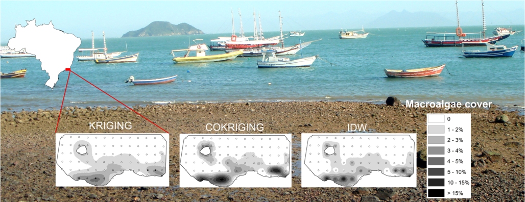
Creating of distribution maps of marine biota from modeling is significant, as they can be used as important tools for managing a protected area and also they are essential to identify any changes in the space after environmental monitoring. However, to produce reliable distribution maps, choosing the best interpolation method from the sampled data is critical. This study to assess the feasibility of using modeling to predict the distribution of benthos in the subtidal regions of rocky shores. In addition, this study compares the power of predictability between the geostatistical methods of kriging and the cokriging, using bathymetry as a covariate. Furthermore, it also evaluates a deterministic method, also known as Inverse Distance Weighting (IDW). The modeled variables include large groups such as macroalgae and corals, as well as one of their representatives in each group (coralline algae and the coral Siderastrea stellata, respectively). The results indicate that although kriging method presents good predictability for some variables, the use of bathymetry as a covariate in the cokriging method produces more accurate maps, especially when using the Gaussian model fit. The maps modeled by IDW are more accurate when using weight 3, however, the maps produce many undesirable isolines. It is concluded that the use of cokriging with bathymetric data is the interpolation method most suitable for benthic marine organisms of the subtidal regions of rocky shores.
Apontamentos
- Não há apontamentos.

Este trabalho está licenciado sob uma Licença Creative Commons Attribution 3.0 .